RightSpot™
In today’s economic climate, resources are limited, and cost savings and cost avoidance are critical. The immense size and complexity of data assets have made it difficult for organizations, municipalities, counties and others to easily capture, retain, and distribute meaningful geo-located information throughout the organization in a timely, cost effective manner. RightSpot™ provides low-cost collaboration and support that allows you to access your data and leverage the power of GIS.
Many small organizations like municipalities or counties struggle with the cost of geospatial technology, staffing, and data management where limited resources and cost savings are the norm. Spatial Engineering developed RightSpot™ services to help those smaller organizations where staffing or capability toward geospatial technology is limited. RightSpot™ is a collection of services and technologies designed to provide GIS services as you need them. RightSpot™ manages your data and limits access to your organizations internal users. It is not a public site. RightSpot™ is your organization’s GIS department.
With Spatial as your GIS department, SPATIAL updates data based on your priority working as an extension of your organization. Updates are available to users on their computer, tablet, and smart phone. SPATIAL maintains up-to-date technologies and functionalities. RightSpot™ is GIS leverage, sustainability and mobile functionality.
RightSpot™ Services
Map Services include geospatial (CADD/GIS) services which augment or serve as your mapping department.
- Access to geospatial analysts and technicians for map building and product creation
- Expert advice on practical and cost effective methods for updating, collecting, and managing data
- Standard desktop, tablet, and smartphone access
- GPS data collection and as-built verification at centimeter accuracy
- Low-altitude aerial imagery collection using Drone technology
- Simple tools to automate standard business processes like mailing labels, work order impacts, and flood zone reports
- Consistent, regular, and verified data updates
- Secure access to your data
- 24/7/365 access to your data
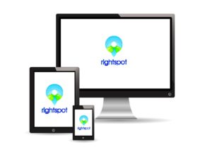 RightSpot™ is accessible from PC,
tablet, or mobile device with a
network connection.