ISIP, USARCENT, Shaw AFB
 Infrastructure Spatial Intelligence Portal (ISIP) is an enterprise geospatial project in which Spatial Engineering (SPATIAL) planned, developed, and has continued to manage for the US Army Central (USARCENT) Command for over 7 years. USARCENT has the Title 10 responsibility for base camp infrastructure data (real property and real estate); and management of all Army engineer construction, executing and reporting efforts within southwest Asia (SWA). Recognizing their need, USARCENT turned to SPATIAL
 The plan centers on an enterprise geospatial database that supports desktop, web and remote clients at hundreds of sites across 13 UTM zones in 25 countries. SPATIAL developed a prototype, implemented the ISIP Plan, maintained and enhanced the GIS portal (ISIP) using onsite personnel: a full-time Geospatial Manager (GM) and Oracle Database Administrator (DBA), a Geospatial Analyst (GA), and a System Administrator (SA). In addition, to sustaining and maintaining ISIP functionality, SPATIAL is tasked to obtain ISIP’s Department of Defense Information Assurance Certification and Accreditation Process (DIACAP) Approval (Authority to Operate – ATO). USARCENT contracted SPATIAL to capture, organize spatial and non-spatial authoritative, reliable data for all real property assets within ARCENT’s AOR to comply with Title 10 requirements.
Project Benefits
- An Enterprise GIS was stood up with Oracle 11g database with Oracle Spatial (SDO_GEOMETRY), and ArcGIS
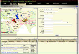
- Expanded ISIP to include an Enterprise Document Management System (EDMS) using Oracle WebLogic and Oracle MapViewer, and MapBuilder
- Cataloged and created metadata for 500,000-plus documents and upload into the EDMS database within ISIP
- Created SDSFIE GIS features from environmental documents using CADD/GIS technologies best suited for specific requirement
- Acquired ≤ 1 meter resolution imagery for more than 400 base camps
- Organized raster data geographically and chronologically for 400 sites for a 7 year history span (over 3,000 images)
- Georeferenced, mosaicked, and tiled 3,000-plus satellite images using ERDAS Imagine, LizardTech GeoExpress (MrSID), and ArcGIS
- Extracted and digitized features from imagery into SDSFIE GIS features using “best of breed” CADD and GIS technologies.
- Deployed a survey team in Theater to collect and verify assets and attributes at key locations throughout the AOR. Develop SDSFIE formats for mobile GPS devices used by the survey team. Collected about 337,000 GIS features using IKE GPS device.
- Developed web-based online viewer capability to share survey data, extractions, imagery and photos via an unclassified network.
- Create WebMapService (WMS) for 3000-plus satellite images spanning 7 year history in CENTCOM’s AOR using LizardTech’s GeoExpress Sever and Oracle MapViewer
- Georeferenced CADD data and imported features to Oracle ArcSDE geodatabase in SDO format using Bentley MicroStation Geographic, Bentley Map, AutoCAD Map3D, ArcGIS Desktop, ArcGIS SDE, Oracle 11g, and Oracle Spatial.
- Created and loaded into ISIP 300+ distinct SDSFIE Feature-classes with 500,000+ features and 50,000,000+ attributes.
Project Highlights
- SDSFIE Compliant
- Application Design and Support of an Enterprise Geospatial Solution
- GIS/CADD Training
- Data Collection