ePRISMS Fort Belvoir, VA
 Conduct an Enterprise Pro-active Real Property Interactive Space Management Systems (ePRISMS) survey and provide the DGN files with polygons and metadata. SPATIAL surveyed 170 buildings with 334 floors covering approximately 5,623,550 square feet.
• Photos: Photograph front and oblique that shows two sides of the building.
• Building Exteriors: Verified and updated the exterior dimensions of all buildings surveyed. Laser measuring devices had 0.25 inches accuracy or better.
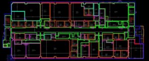
• Building Interiors: Verified and updated existing CADD floor layouts, structural columns, walls, permanent or semi-permanent partitions, locations of doors and windows. Created new CADD floorplans if data did not exist. Laser measuring devices had 0.25 inches accuracy or better.
• Room Numbers: Verified and updated room numbers within the building.
• Space Use: Verify space occupancy count and type, category code, unit identification code (UIC) and unit description.
• ePRISMS Space Files (PSF): All spaces within a floorplan were digitized to create space polygons per the QAP using MicrostationV8i.
• ePRISMS Space and Manpower (SMP): Personnel count, type, category code, UIC, area, and etc. were entered into the standard SMP templates.
Project Highlights
• ePRISMS QAP Compliant
• Space and Manpower Survey
• Updated Floor Plans
• Facility Photos
• Laser Measurements with ¼” Accuracy
• Automated Workflows
• Spatial Enabled Document Management